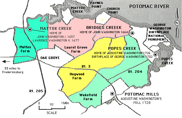
This is a map of the George Washington ancestrial plantation region, redrawn from a National Park Service pamphlet issued for visitors to the George Washington Birthplace National Monument. This map shows Mattox Creek and Mattox Farm. (U.S. Government Printing Office 16-20707)
According to current maps, Mattox Creek still exists as shown above, there is a Mattox Avenue (a.k.a. State highways 1312 and 1324) along the southern edge of Mattox Creek, and a Mattox Drive to the north, near Paynes Point.
Back to Mattox Home